The United Nations has designated
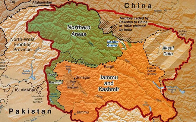
Kashmir as a disputed territory on its standard world map. The General Assembly
approved a resolution on adopting a new map, with India also voting in favor of
the resolution. The resolution adopted by the United
Nations supports replacing the traditional Mercator projection with the Equal
Earth projection. A total of 164 countries, including India, voted in favor of
the UN’s standard Equal Earth map. The map has challenged India’s long-standing
narrative that Kashmir is an integral part of the country.
The world map presented by the
United Nations shows Kashmir as a disputed territory, while the Line of Control
(LoC) is marked with a dotted line. This has once again highlighted Kashmir’s
disputed status at the international level. By voting in favor of a world map
that depicts Kashmir as a disputed territory, India has faced criticism over
its long-standing position on the region. The vote has also raised questions
about New Delhi’s claim that Kashmir is an internal matter of India. Following domestic criticism,
India’s Ministry of External Affairs issued a vague clarification, stating that
its vote was in support of the geographical proportions of the map and not the
borders depicted on it.
Pakistan’s Ministry of Foreign
Affairs rejected the Indian clarification, stating that the map approved by the
United Nations is internationally recognized and that Kashmir’s disputed status
is clearly established through UN resolutions. It is worth noting that India has
for decades used mapping laws and regulations to put pressure on technology
companies and international organizations over the depiction of its borders.
Pakistan maintains that India’s vote in favor of the UN’s standard map supports
its principled position on the Kashmir dispute.